Hello,
I am very new to using VIktor and Python and have a question. I was tinkering around with placing polygons on maps and positioning markers. I wanted to know how I can check if this marker falls within the bounds of the polygon. If this explanation isn’t clear enough or if you need more information, please let me know.
Greetings,
Floris
Hi @Floris1 ,
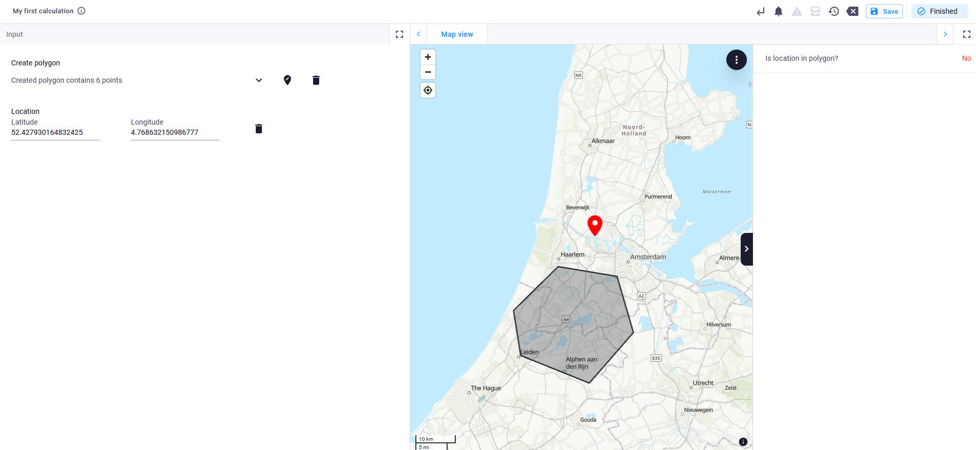
Welcome to the community! Here is a snippet of a working app. Hope it helps:
from viktor.parametrization import (
    ViktorParametrization,
    GeoPolygonField, GeoPointField,
)
from viktor import ViktorController, Color
from viktor.views import (
    MapPoint, MapPolygon, MapAndDataView, MapAndDataResult, DataGroup, DataItem, DataStatus,
)
from shapely.geometry import Point, Polygon


def point_in_polygon(point_coord, polygon_coords):
    # Create a Polygon object
    polygon = Polygon(polygon_coords)

    # Sample point coordinates (longitude, latitude)
    point = Point(point_coord)

    # Check if the point is within the polygon
    return polygon.contains(point)


class Parametrization(ViktorParametrization):
    polygon_field = GeoPolygonField("Create polygon")
    location = GeoPointField("Location")


class Controller(ViktorController):
    label = "My Entity Type"
    parametrization = Parametrization

    @MapAndDataView('Map view', duration_guess=1)
    def get_map_view(self, params, **kwargs):
        # Create some points using coordinates
        features = []

        # Create a polygon
        if params.polygon_field:
            polygon = MapPolygon.from_geo_polygon(params.polygon_field)
            features.append(polygon)
        if params.location:
            location = MapPoint.from_geo_point(params.location, color=Color.red())
            features.append(location)

        if params.polygon_field and params.location:
            point_coord = (location.lon, location.lat)
            polygon_coords = [(pnt.lon, pnt.lat) for pnt in polygon.points]
            in_polygon = point_in_polygon(point_coord, polygon_coords)
            data = DataGroup(
                DataItem('Is location in polygon?', 'Yes' if in_polygon else "No", status=DataStatus.SUCCESS if in_polygon else DataStatus.ERROR)
            )
        else:
            data = DataGroup()

        return MapAndDataResult(features, data)
Make sure to add shapely to the requirements.txt